Rafting is the activity the Cetina Canyon is best known for. The management plan for the protected area calls it the most common of the adventure activities in the canyon, ahead of kayaking and canoeing, canyoning and the passenger boats. Every rafting company on this stretch works under a concession from More i krš, the public institution that manages the canyon.
The route: Penšići to Radmanove mlinice
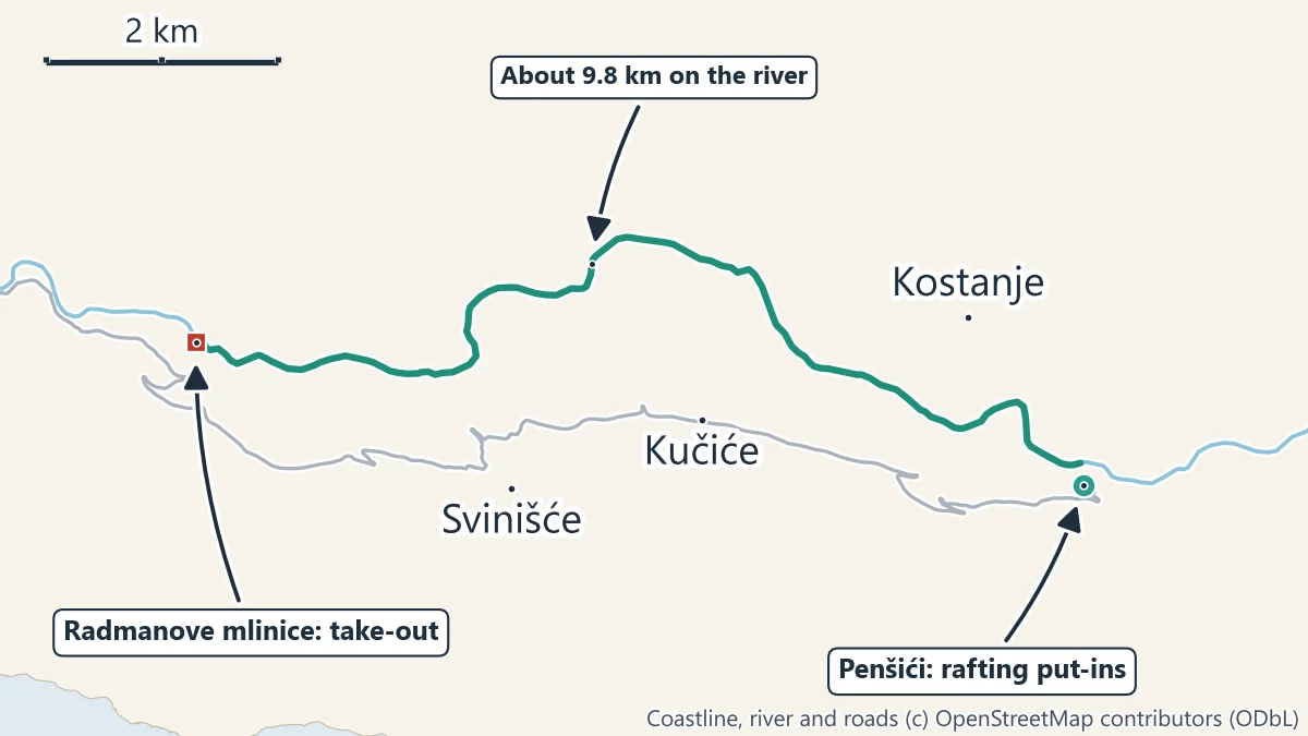
The management plan describes the put-ins as several entry points on private land at Penšići, and the take-outs as several exit points at Radmanove mlinice. Between them the river runs about 9.8 km through the middle of the canyon, below the villages of Podgrađe, Kostanje, Kučiće and Svinišće.
Above Radmanove mlinice, the plan notes, the Cetina has cut its bed partly into flysch and partly into limestone and formed short rapids, and in five places it breaks through a ridge in a short, steep gorge where the walls close in on both sides. That mix, short rapids between long calm pools, is what a Cetina rafting trip is like: more of a float through a gorge than a white-water ride.
Some companies start higher up, at Slime, about 12.5 km above the mills on the river. Ask which put-in your trip uses.
How a trip runs
- Meeting point. Most companies meet in Omiš, some in Zadvarje, and drive the group up to Penšići. The drive from Omiš is 17.8 km by road.
- Briefing and kit. You get a helmet, a life jacket and a paddle, and in cooler water a wetsuit. The guide explains the commands and what to do if you fall in.
- On the river. About two and a half to three hours on the water, with stops. Many trips stop for a swim, and some for a jump from a rock or a look into a small cave beside the river.
- Take-out at Radmanove mlinice. The trip ends at the mills, where the restaurant and the picnic ground are, and the company drives you back to Omiš. With the briefing and transfers, allow about four hours.
Water level and the power stations
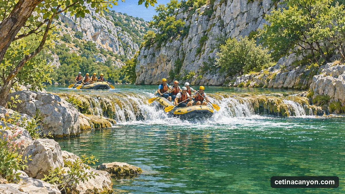
The Cetina at this point is not a free river. Its water is held upstream in the Prančevići reservoir and diverted to the Zakučac power station near Omiš; the river through the canyon carries what is released from the dam, including a biological minimum flow. The management plan notes that the level falls considerably in the dry summer months, and that the river users complain that low water makes their craft scrape the tufa barriers in the riverbed.
The other side of the same system is a sudden rise. The power company sends warnings of planned releases from the reservoirs, which More i krš forwards to the licensed operators, so that nobody is caught in the riverbed when a wave of water comes down. This is the main reason to raft with a licensed company and never on your own.
What to bring
- Swimwear under your clothes, and a towel and dry clothes for the end.
- Shoes that can get wet and stay on your feet: trainers or river sandals with straps, not flip-flops.
- Sun cream and a hat; the canyon floor gets hot in summer.
- Nothing you cannot afford to lose in the water. Leave phones and keys with the company if it offers dry storage.
Tufa and the protected canyon
The pale, porous rock you float over at every small fall is tufa, laid down by the river’s own water. The management plan counts the tufa barriers among the values the protection exists for, and the planned rules for visitor infrastructure require that the tufa is not damaged. Do not stand on, climb or break the barriers, and keep to the put-ins and take-outs the guide uses. The plan also foresees fewer, fixed entry and exit points for the rafts in future, set in the concessions.
Rafting, canyoning or the boat?
Rafting is the middle option: more water and effort than the river boat from Omiš, far less than canyoning at Zadvarje. The comparison page sets them side by side.