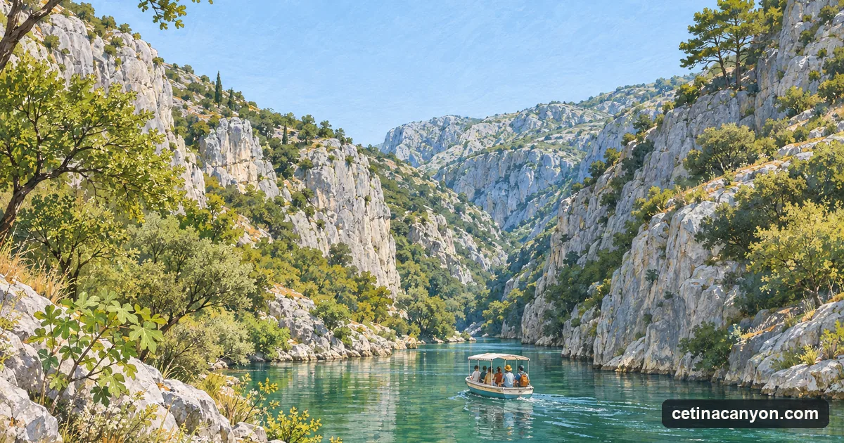
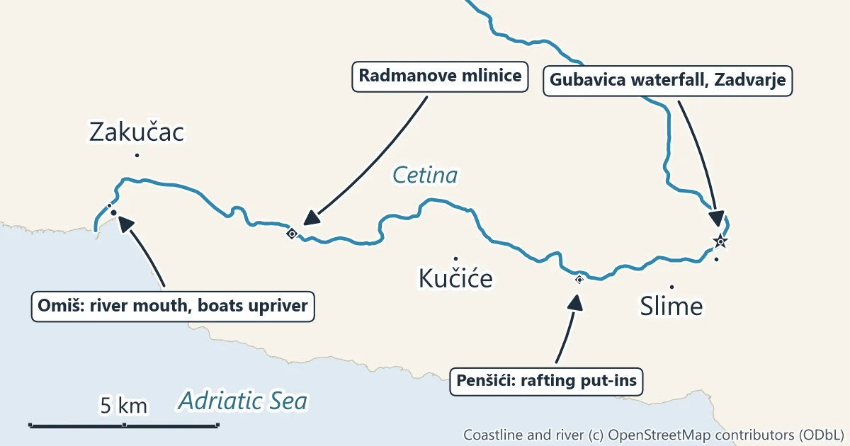
The Cetina rises in the Dinaric karst and reaches the Adriatic at Omiš, a small town between Split and Makarska. Its last stretch is the canyon: from the Gubavica waterfalls at Zadvarje the river runs about 20 km to the sea, in a gorge that is narrow and walled in places and opens out into terraced slopes and small villages in others. The water is the green that gives the river its photographs, and the canyon is where Omiš runs its rafting, canyoning, zipline and boat trips.
What the canyon is
The management plan for the protected area describes two landscapes. Upstream of Zadvarje the river has cut its canyon into the limestone plateaus; below the Gubavica falls it runs on through softer flysch rock to the sea, with gentler slopes and a much shallower fall. The steepest drop of the whole river is at Gubavica: over 1.5 km the riverbed falls 166 m, most steeply at the Velika Gubavica falls.
Between Gubavica and the sea the river still breaks through ridges in short, steep passages. The plan singles out two: the narrows of Tisne stine, by the Visečki kuk ridge, and the gap between the Komornjak and Rat ridges just before the river reaches Omiš. That last gap is the view you get from the bridge in Omiš: the river leaving a slot between walls of rock.
Villages sit on the terraces above the water: Zakučac, Kučiće, Svinišće, Slime and others. The Omiš tourist board describes them as old farming villages that have become popular with visitors, many of them for food grown on their own land.
Gubavica waterfall
Velika Gubavica, 49 m high, and Mala Gubavica, 7 m, are the two waterfalls at Zadvarje where the river drops from the upper canyon into the lower one. A short walk from the main road in Zadvarje leads to a viewpoint over the falls and the gorge. The Kraljevac hydroelectric plant, built in 1912 below the falls, uses the same drop, so the amount of water going over them varies. The Gubavica waterfall guide has the walk and the map.
Radmanove mlinice
Radmanove mlinice, the Radman mills, is the best-known place in the canyon: an old mill complex on the river 6 km from Omiš, taken over by the Radman family in the 19th century and turned into a restaurant and picnic ground under tall trees. It is where the river boats from Omiš turn round and where the rafting trips finish. The Omiš tourist board notes that it was one of the filming locations of the Winnetou films of the 1960s. See the Radmanove mlinice guide.
On the river: boat, rafting, canyoning, zipline
The management plan names rafting as the most common activity in the canyon, followed by kayaking and canoeing, canyoning, the passenger boats and climbing. All of them are run by companies that hold a concession from More i krš, which has issued them since 2006.
- River boat. Boats leave from the river banks by the bridge in Omiš and go 6.2 km upriver to Radmanove mlinice and back. It is the easy way to see the lower canyon: the river boat trip.
- Rafting. Rafts put in at Penšići, near Zadvarje, and come out at Radmanove mlinice, about 9.8 km down the river, through small rapids and calm pools: Cetina river rafting.
- Canyoning. Canyoning trips go into the gorge at Zadvarje and come out near the Kraljevac power station, swimming, jumping and, on the harder trips, abseiling beside the Gubavica falls: canyoning on the Cetina.
- Zipline. Eight wires with a total length of 2,100 m cross the canyon near Omiš, around the Visečki kuk ridge.
- Climbing. The plan counts 12 equipped crags with 175 routes inside the protected area.
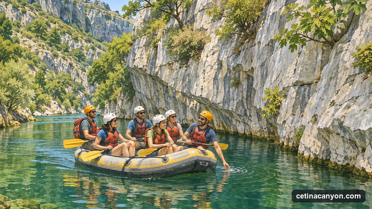
Not sure which to choose? Rafting, canyoning or the boat compares them side by side.
Getting there from Split
| From | To | By road | Straight line |
|---|---|---|---|
| Split bus station | Omiš bridge | 25.2 km | 21.0 km |
| Omiš bridge | Radmanove mlinice | 5.9 km | 4.9 km |
| Omiš bridge | Penšići (rafting put-ins) | 17.8 km | 12.7 km |
| Omiš bridge | Zadvarje | 30.0 km (inland road) | 16.2 km |
| Split bus station | Zadvarje | 60.2 km (motorway) | 37.0 km |
Road figures are routed along the road network between the two points named; straight-line figures are the distance between the same points on the map. Promet Split’s line 60 runs from Split to Omiš. Up the canyon there is no regular bus to the activity starts: rafting and canyoning companies usually arrange transport from Omiš, and the boats leave from the town itself. The Split to the Cetina Canyon guide has the details.
Water levels and the power stations
The Cetina is a working river. The management plan lists the hydroelectric plants that take its water: Kraljevac at Zadvarje, the oldest on the river, and Zakučac near Omiš, opened in 1962 and the largest hydroelectric plant in Croatia, which is fed from the Prančevići reservoir at the top of the protected canyon. Below the dam the river carries what the plants release, including a biological minimum flow set in their operating rules.
Two practical results follow. In the dry summer months the river level falls considerably, and the boat and raft operators report that low water makes their craft scrape the tufa barriers in the riverbed. And when the reservoirs release water, the level can rise quickly: the power company sends warnings of planned releases, which More i krš passes on to the licensed operators. Go on the river with a licensed company, which receives those warnings, and follow its guide.
Staying safe
- Do not go into the gorge alone. Canyoning and the upper canyon at Zadvarje are for guided groups with ropes, helmets and wetsuits.
- Watch the water level. A sudden rise after a release is the main hazard on this river. Stay out of the riverbed near the power stations.
- Mind the tufa. The pale, crumbly rock in the riverbed is tufa, built up by the water over centuries. It is slippery, and the management plan counts it among what the protection is for: do not stand on or break the barriers.
- Heat and sun. Summer days in the canyon are hot and the trails above it have little shade. Carry water on any walk.
Protected status
The first protection came in 1963, when Croatia’s nature protection institute protected 1,100 hectares of the lower canyon, from Tisne stine above Radmanove mlinice to the sea. On 21 December 2016 the Split-Dalmatia County Assembly declared a significant landscape (značajni krajobraz) of 6,492.99 hectares from the Prančevići dam to the sea, which takes in parts of the villages along it; it replaced the 1963 protection when it came into force in 2017. The canyon is also part of the Natura 2000 network, and More i krš names its endemic fish, its cliff-nesting birds and the river mouth, where fresh and salt water mix, among its values. It is managed by More i krš, the county’s public institution for protected nature, under a management plan for 2024 to 2033.
Official information
- Kanjon rijeke Cetine on moreikrs.hr, the page of More i krš, the public institution that manages the canyon (in Croatian).
- The Cetina Canyon on visitomis.hr, the Omiš tourist board.
- The management plan 2024 to 2033, published by the Ministry of Economy and Sustainable Development (PDF, in Croatian).